
HAWAII FISHING GUIDES
Hawaii Fishing Maps
Browse fishing grounds, seafloor depths and offshore reference maps by island. These historic charts are informational, not live conditions or navigation guidance.
Hawaii Fishing Maps and Offshore Reference Charts
These maps are provided as general reference material and may not reflect current ocean conditions, FAD locations, tides, or navigation information. For current conditions and safe trip planning, consult official marine forecasts and your charter captain.
OAHU SEA CONDITIONS:
Water Depths (feet)
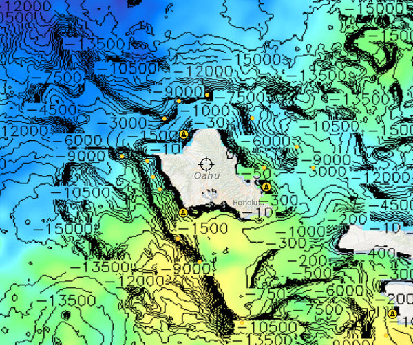
Oahu Sea Currents

Oahu FAD's (Fish Aggregation Devices)
The State of Hawaii has placed Fish Aggregating Devices (FADs) in the waters surrounding the main Hawaiian Islands. These buoys attract schools of tuna and other important pelagic fishes, such as dolphinfish (Mahimahi), wahoo (Ono), and billfish. FADs allow fishermen to easily locate and catch these species.

Oahu Sea Surface Heights

Oahu Fishing Grounds

MAUI SEA CONDITIONS
Water Depths (feet)

Maui Sea Currents

Maui FAD's (Fish Aggregation Devices)
The State of Hawaii has placed Fish Aggregating Devices (FADs) in the waters surrounding the main Hawaiian Islands. These buoys attract schools of tuna and other important pelagic fishes, such as dolphinfish (Mahimahi), wahoo (Ono), and billfish. FADs allow fishermen to easily locate and catch these species.

Maui Sea Surface Heights

Maui Fishing Grounds

KAUAI SEA CONDITIONS
Water Depths (feet)

Kauai Sea Currents

Kauai FAD's (Fish Aggregation Devices)
The State of Hawaii has placed Fish Aggregating Devices (FADs) in the waters surrounding the main Hawaiian Islands. These buoys attract schools of tuna and other important pelagic fishes, such as dolphinfish (Mahimahi), wahoo (Ono), and billfish. FADs allow fishermen to easily locate and catch these species.

Kauai Sea Surface Heights

Kauai Fishing Grounds

BIG ISLAND SEA CONDITIONS
Water Depths (feet)
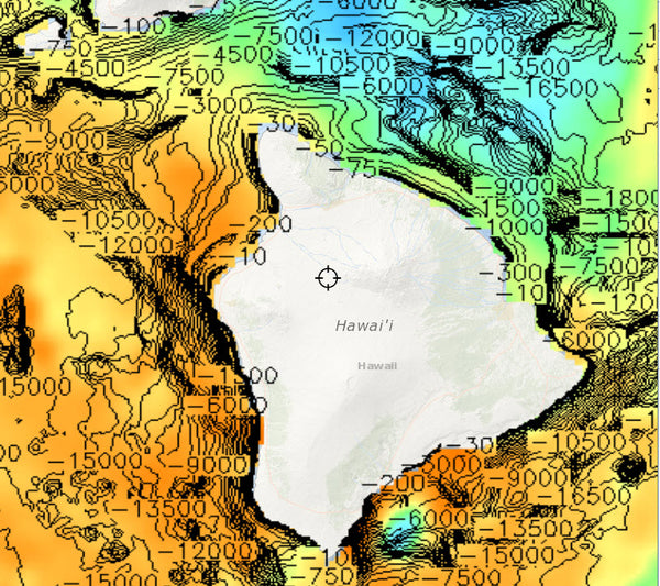
Big Island Sea Currents

Big Island FAD's (Fish Aggregation Devices)
The State of Hawaii has placed Fish Aggregating Devices (FADs) in the waters surrounding the main Hawaiian Islands. These buoys attract schools of tuna and other important pelagic fishes, such as dolphinfish (Mahimahi), wahoo (Ono), and billfish. FADs allow fishermen to easily locate and catch these species.

Big Island Sea Surface Heights

Big Island Fishing Grounds

Ready to plan a fishing trip?
Explore charter boats and trip options or ask our Hawaii-based team for assistance.